Battlefield, Eutaw Springs, S.C.

Battle site, Eutaw Springs, S.C.

The Battle of Eutaw Springs (1781) was the last major battle of the Revolutionary War between colonists and the British.  The South is filled with historic markers that outline history of the area.  In many places, they’re being packaged by state tourism bureaus as history trips.

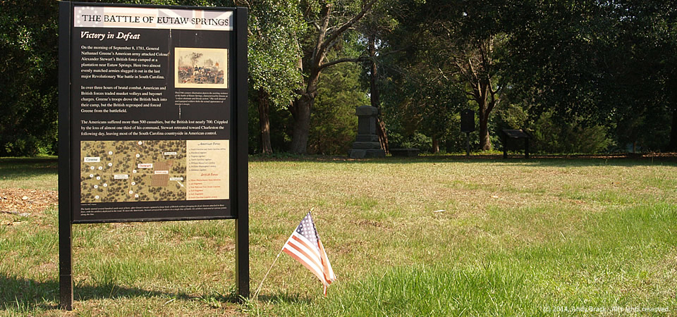
Today at the site of the battle, just east of the town of Eutawville in Orangeburg County, is a memorial park with information placards that explain what happened.  In the background under shade trees, you can see some memorials that honor the combatants.

The descriptive sign in this picture reads:

Victory in Defeat

On the morning of September 8, 1781, General Nathanael Greene’s American army attacked Colonel Alexander Stewart’s British force camped at a plantation near Eutaw Springs.  Here two almost evenly matched armies slugged it out in the last major Revolutionary War battle in South Carolina.

In over three hours of brutal combat, American and British forces traded musket volleys and bayonet charges.  Greene’s troops drove the British back into their camp, but the British regrouped and forced Greene from the battlefield.

The Americans suffered more than 500 casualties, but the British lost nearly 700.  Crippled by the loss of almost one third of his command, Stewart retreated toward Charleston the following day, leaving most of the South Carolina countryside in American control.

Photo by Andy Brack, July 9, 2014.  Copyrighted and all rights reserved.
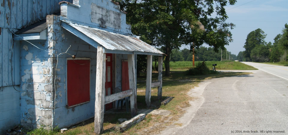
Old joint, Clarendon County, S.C.

Old joint, Clarendon County, S.C.

We’re not exactly sure what this old place is, but figure it probably most recently was a rural joint, preceded by being a country store of some sort.  Likely as not, there have been some very good times had here.  The run-down building, located along S.C. Highway 261 between Manning and Kingstree, S.C., is in agricultural Clarendon County.

Clarendon County has 34,357 people, according to the U.S. Census Bureau’s 2012 population estimate.  About half of the county’s residence are white; the other half are black.  Some other statistics:

  • High school graduation rate of those 25 or older:  76.3 percent.
  • Bachelor’s degree graduates:  13.8 percent
  • Median household income:  $33,267
  • Poverty rate:  22.8 percent

Photo taken July 9, 2014, by Andy Brack.  Copyrighted; all rights reserved.

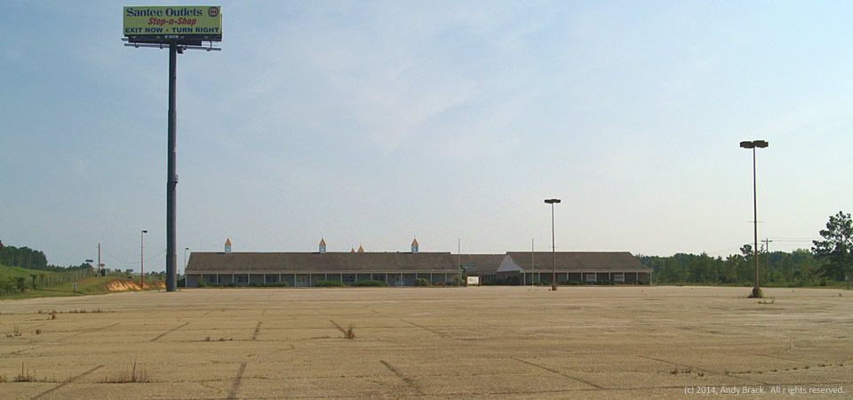
Deserted, Santee, S.C.

Empty, deserted mall, Santee, S.C.

Santee Outlets used to be a thriving outlet village in the small town of Santee, S.C., along Interstate 95 in the middle of a real dull drive between Savannah, Ga., and Florence, S.C.  Now, however, the facility — once home to about four dozen stores — houses an antiques store and a sheriff’s department substation.  A parking lot that could fit hundreds of cars is empty with weeds and broken glass as its only occupants.

While small shops and fast-food restaurants thrive at the Santee exit, small businesses like those in the outlet took a big hit in the Great Recession.  Santee, home to about 750 people, is in the eastern part of Orangeburg County near Lake Marion.  Orangeburg County is home to more than 91,000 people, two thirds of whom are black.  The county has a poverty rate of 24.5 percent.

Copyrighted photo was taken July 9, 2014 by Andy Brack.  All rights reserved.

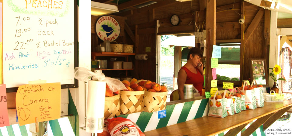
Roadside stand, Eutawville, S.C.

Peaches at the St. Julien Plantation produce stand, outside Eutawville, S.C.

Patti Connor takes a phone call at the St. Julien Plantation roadside produce stand just outside Eutawville, S.C.  At this time of the year, you can find these stands across the rural South offering fresh fruits and vegetables such as peaches, corn, peas, melons, okra and more.

Eutawville, population about 350, is the site of the important Battle of Eutaw Springs, the last major battle of the Revolutionary War in South Carolina.  (More on this in the days ahead.)  The small town is in the eastern part of Orangeburg County near Lake Marion.

Orangeburg County is home to more than 91,000 people, two thirds of whom are black.  The county has a poverty rate of 24.5 percent.

Copyrighted photo was taken July 9, 2014 by Andy Brack.  All rights reserved.

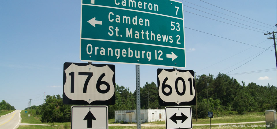
Deserted intersection, Calhoun County, S.C.

Calhoun County, S.C., intersection

A deserted store is at one corner of an empty intersection in Calhoun County, S.C.  Back in the day before Interstate 26, which is a few miles to the south, this place would have been a busy gathering place for local residents and travelers going between Charleston and the state capital city, Columbia.

Much of Calhoun County is very rural, but because part of it abuts the Columbia metro area, its poverty rate is a little lower than most Crescent areas.  Poverty is 18.2 percent, according to a five-year Census average, less than a point higher than the state average.  The county is, however, relatively small at just over 15,000 people.  About 43 percent of residents are black with whites comprising 55 percent.

Photo taken June 18, 2014, by Andy Brack.  Copyrighted.  All rights reserved.

Near the Pig, Orangeburg, S.C.

Russell Street, Orangeburg, S.C.

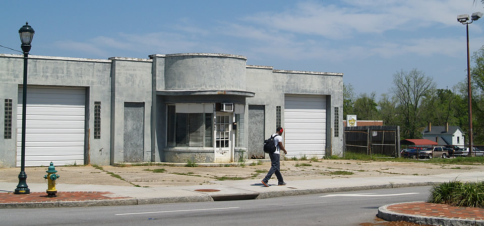
This crumbling corner on Russell Street near the center of downtown in Orangeburg, S.C., illustrates the challenge that the inner city is having to attract businesses to lure residents to spend time in their downtown.  Despite an attractive central downtown renovation and business like Piggly Wiggly, which you can see in back of this apparently empty old service station, there are few big-name retailers to draw people downtown.

The City of Orangeburg, known for its gardens and historically black colleges, officially is home to 13,850 people and has a 31.3 poverty rate in 2012, but the greater area has more than 65,000 people.  Orangeburg County is home to more than 91,000 people, two thirds of whom are black.  The county has a poverty rate of 24.5 percent.

Copyrighted photo was taken April 23, 2014 by Andy Brack.  All rights reserved.

Downtown park, Orangeburg, S.C.

Downtown Orangeburg, S.C.

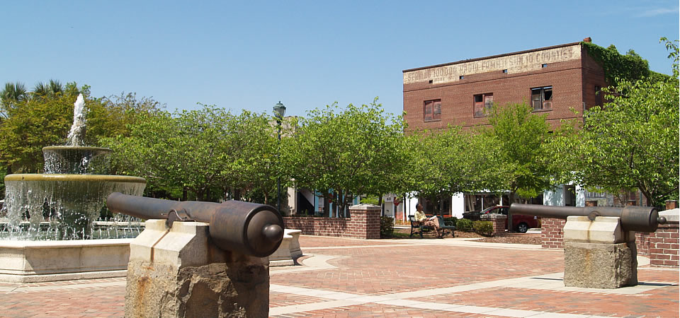
This fountain and brick area in the middle of downtown Orangeburg provides a central oasis of sorts.  Nearby are big local churches and lots of small businesses from finance shops to hair boutiques.  The old square area also features a Confederate statue.

The City of Orangeburg, known for its gardens and historically black colleges, officially is home to 13,850 people and has a 31.3 poverty rate in 2012, but the greater area has more than 65,000 people.
Orangeburg County is home to more than 91,000 people, two thirds of whom are black.  The county has a poverty rate of 24.5 percent.

Copyrighted photo was taken April 23, 2014 by Andy Brack.  All rights reserved.

Tin cabin, Orangeburg County, S.C.

Old cabin, Orangeburg County, S.C.

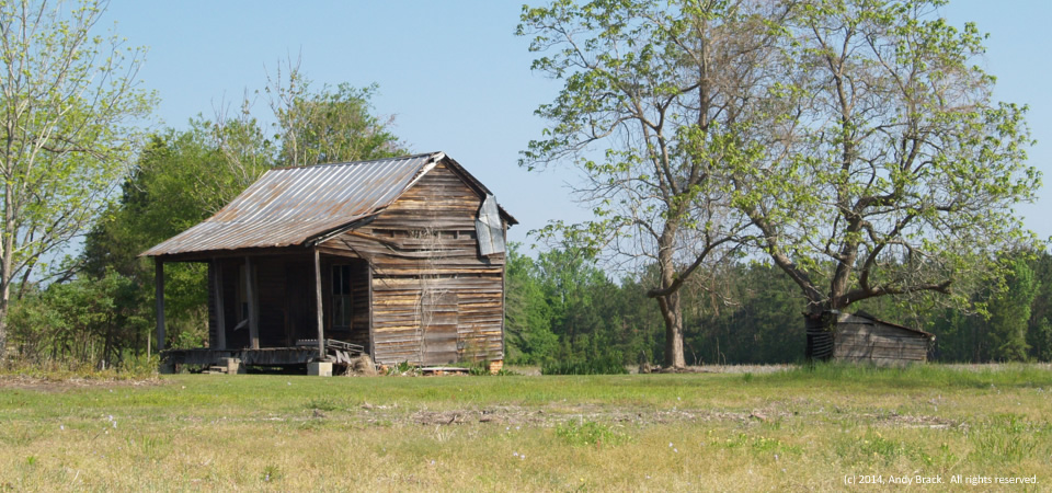
This old one-room cabin with a tin roof is just inside Orangeburg County on U.S. Highway 178 near the Dorchester County line.  Although it’s seen its better days, you can imagine tenant farmers from 80 or more years ago sitting on the front porch.

Orangeburg County is home too more than 91,000 people, two thirds of whom are black.  The county has a poverty rate of 24.5 percent.  The City of Orangeburg, known for its gardens and historically black colleges, officially is home to 13,850 people and has a 31.3 poverty rate in 2012, but the greater area has more than 65,000 people.

Copyrighted photo was taken April 23, 2014 by Andy Brack.  All rights reserved.

Pothole, Orangeburg County, S.C.

Pothole, near Bowman, S.C.

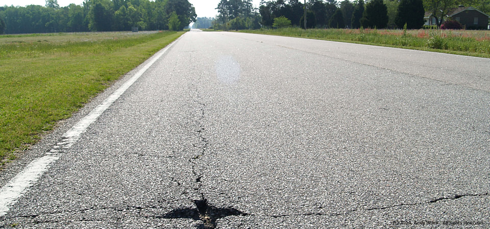
This pothole on U.S. Highway 178 east of Bowman is just one of a gazillion pitting South Carolina roads.  The state has an estimated $27 billion in road and bridge maintenance needs to bring its extensive highway system to being good.  But lawmakers continue to shy from raising the state’s gas tax, one of the lowest in the nation.

Photo by Andy Brack, April 23, 2014.  All rights reserved.

Closed, Orangeburg, S.C.

14.0514.housing

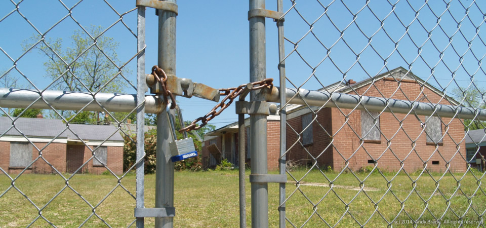
There’s a padlocked chain-link fence around what obviously was a public housing complex in Orangeburg, S.C.  The units, boarded up with decaying plywood, are located near the intersection of Boulevard and Wannamaker streets about a mile from S.C. State University’s campus in a neighborhood with homes of wide-ranging value.

The City of Orangeburg, known for its gardens and historically black colleges, officially is home to 13,850 people and has a 31.3 poverty rate in 2012, but the greater area has more than 65,000 people.
Orangeburg County is home to more than 91,000 people, two thirds of whom are black.  The county has a poverty rate of 24.5 percent.

Copyrighted photo was taken April 23, 2014 by Andy Brack.  All rights reserved.