Chimneys, Morrisville, S.C.

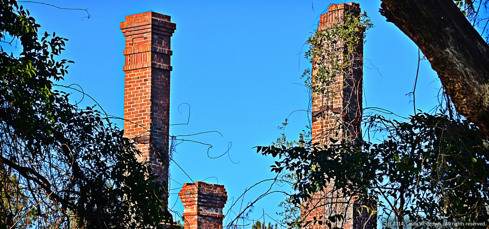
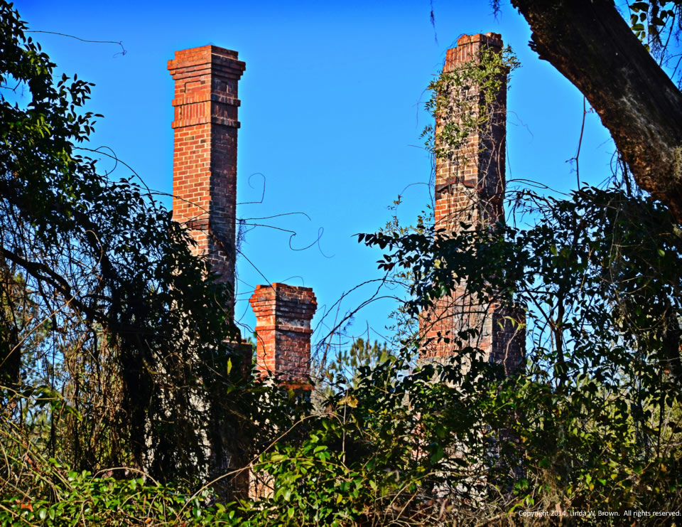
14.0209.chimneys2

“These chimneys are all that remain of a once-stately home in the Old Morrisville section of Williamsburg County, S.C.,” writes retired editor and photographer Linda W. Brown of Kingstree.  “All too many of these old home have been allowed to decay and are very often replaced by manufactured housing.”

Williamsburg County, which is about 75 miles north of Charleston, S.C., has a population of just under 34,000 people.  Population peaked in 1950 at 43,807, but has dropped slowly since then.

About two-thirds of county residents are black, with almost  all of those remaining being white.  Only 2 percent of those in the county are of Hispanic descent.  Some 32.8 percent of residents live in poverty, according to the Census.  Of the county’s 1,921 firms, 36.5 percent are black-owned — a percentage that is three times South Carolina’s average.

Photo taken Jan. 19, 2014, by Linda W. Brown.  All rights reserved.
Farm buildings, Round O, S.C.

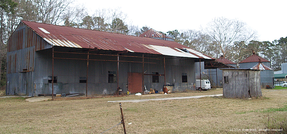
Farm buildings, Round O, S.C.


This old tin farm building and nearby short grain silos are in the unincorporated Colleton County community of Round O, which has numerous churches and a small post office. While these buildings look little-used, they are located next to the ACE Basin Milling Company, which seemed to be a busy place on the cold, gray January day when the photo was taken.

According to this Web site, Round O got its name because English settlers found it easier to call the chief of the Cherokee tribe in the area “Round O,” instead of his given name of Chief Attakullakulla, which apparently described a purple medallion tattooed on his shoulder.

About 750 people live in the Round O area.  Colleton County, a Southern Crescent county split by Interstate 95,, is home to 38,153 people, 21 percent of whom live at or below the federal poverty level.

Photo taken January 2014 by Andy Brack.  All rights reserved.

Old garage, Blakely, S.C.

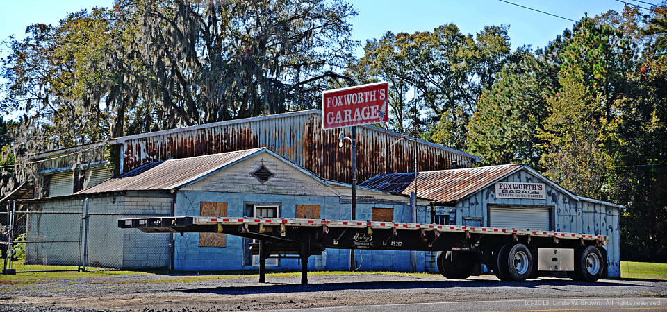
Foxworth's, Blakely, S.C.
Foxworth’s, Blakely, S.C.

Foxworth’s Garage once operated in the Blakely community in Williamsburg County, writes Kingstree, S.C. photographer Linda W. Brown.  The business is still in operation, but in Kingstree, not in this old building.

Kingstree is the county seat for Williamsburg County, which is about 75 miles north of Charleston, S.C.  Just under 34,000 people live in the county.  Population peaked in 1950 at 43,807, but has dropped slowly since then.

About two-thirds of county residents are black, with almost  all of those remaining being white.  Only 2 percent of those in the county are of Hispanic descent.  Some 32.8 percent of residents live in poverty, according to the Census.  Of the county’s 1,921 firms, 36.5 percent are black-owned — a percentage that is three times South Carolina’s average.

Photo taken Nov. 3, 2013, by Linda W. Brown, courtesy of the photographer.  All rights reserved.

Stately old home, Kingstree, S.C.

Thorntree House, Kingstree, S.C.

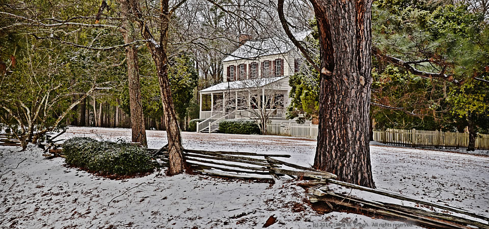
Thorntree House, nestled in recent snow that blanketed much of South Carolina in a rare super-cold snap, is believed to be the oldest home in “Williamsburgh District,” retired editor and photographer Linda W. Brown writes.

“Built in 1749 on Thorntree Swamp near present-day Salters, it was the home of James Witherspoon, one of the early settlers. It was moved to Kingstree in the early 1970s and restored as a ‘house museum.'”  These days, Thorntree is owned and operated by the Williamsburgh Historical Society.

“Small rural historical societies work hard to preserve the history of their communities, but it is becoming more of a struggle with each passing year,” Brown writes.  “Grant funding for this kind of historical preservation has become scarce and funding, in general, is becoming harder to secure. Historical societies depend largely on volunteers, donations and membership dues to continue their preservation work.”

Kingstree is the county seat for Williamsburg County, which is about 75 miles north of Charleston, S.C.  Just under 34,000 people live in the county.  Population peaked in 1950 at 43,807, but has dropped slowly since then.

About two-thirds of county residents are black, with almost  all of those remaining being white.  Only 2 percent of those in the county are of Hispanic descent.  Some 32.8 percent of residents live in poverty, according to the Census.  Of the county’s 1,921 firms, 36.5 percent are black-owned — a percentage that is three times South Carolina’s average.

Copyrighted 2014 photo by Linda W. Brown, courtesy of the photographer.  All rights reserved.

Historic store, Sniders, S.C.

Historic store, Sniders, S.C.

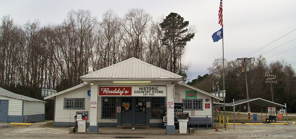
This historic store on U.S. Highway 21 about 10 miles west of Walterboro, S.C., was closed in January 2014, even though it looks well-kept and like it had been open recently.  Look closely and you can see a cat in front of the gray doors.

It’s harder and harder to find country stores like this that are open today.  Once as ubiquitous as mules, they’re dying out as more people move from rural areas to larger cities.

Walterboro, which has lost about 100 people since 2010, has a population of 5,309 people. 38 percent of whom live in poverty.  Walterboro is the county seat of Colleton County, a Southern Crescent county split by Interstate 95.

Colleton County, which also has a small piece of coastline, is home to 38,153 people, 21 percent of whom live at or below the federal poverty level.

Photo taken Jan. 4, 2014, by Andy Brack.  All rights reserved.

No service, Walterboro, S.C.

Closed dealership, Walterboro, S.C.

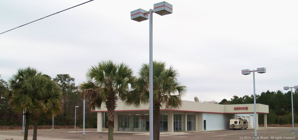
Despite the word “service” on this building outside Walterboro, S.C., there’s no service because this old Pontiac-Buick-GMC dealership is closed, just as many similar dealerships across the South closed during the recent recession.

Walterboro, which has lost about 100 people since 2010, has a population of 5,309 people. 38 percent of whom live in poverty.  Walterboro is the county seat of Colleton County, a Southern Crescent county split by Interstate 95.

Colleton County, which also has a small piece of coastline, is home to 38,153 people, 21 percent of whom live at or below the federal poverty level.

Photo taken Jan. 4, 2014, by Andy Brack.  All rights reserved.

Great barbecue, Holly Hill, S.C.

14.0128.bbq

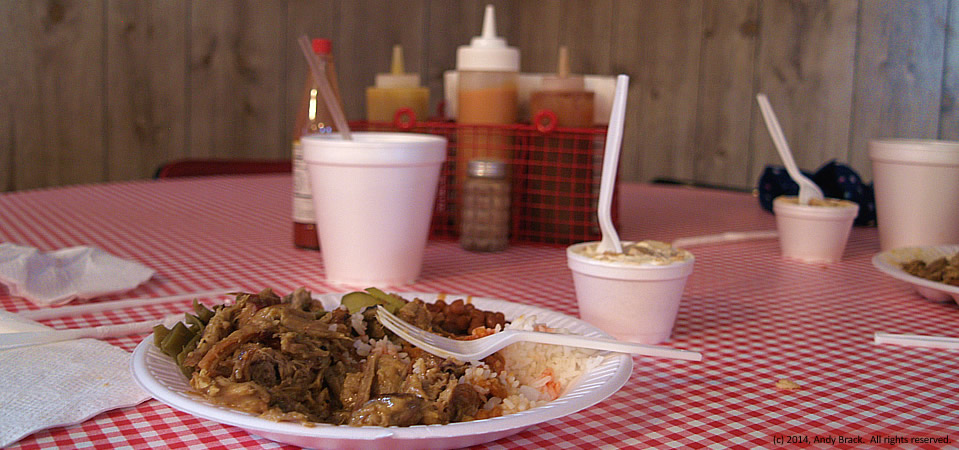
It’s not a cliche that the South, particularly the Crescent South, knows how to make outstanding barbecue, such as this plate from Sweatman’s just outside Holly Hill, S.C.

Holly Hill is in Orangeburg County, which at 1,128 square miles is almost the size of Rhode Island!  The county, home to 91,476 people  in 2012, stretches from Eutawville and its Revolutionary War site in the east near Lake Marion to Springfield and North, more than 60 miles to the west.   Almost two in three residents of the county are black.  Some 24.5 percent of residents live below poverty.

Copyrighted photo was taken in January 2014 by Andy Brack.  All rights reserved.

Sturdy, empty station, Olar, S.C.

Old, sturdy gas station, Olar, S.C.

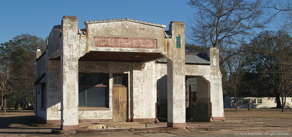
This gutted gas station in rural Olar, S.C., stands as a testament to sturdy buildings that litter the South along major highways in the days before the interstates.  The empty station looks like a perfect place for a movie set for a film of a time long past.

Situated along U.S. Highway 301 in the Bamberg County town of about 200 people, it’s not hard to imagine a booming business located here in the 1950s with big, American cars zooming by and locals stopping by for a Coca-Cola and bag of peanuts.  Across the street today is another abandoned gas station, competition from the past.

Bamberg County is home to about 16,000 people, 27 percent of whom live below the federal poverty level, according to 2012 Census estimates.  The majority of residents are black (61.4 percent) with whites comprising 36.8 percent. 

Photo taken January 2014 by Andy Brack.  All rights reserved.

“Im still here,” North, S.C.

Along Main Street, North, S.C.

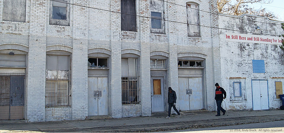
Two guys walk past an empty building on Main Street in North, S.C., on a chilly January day.  What caught our attention about the deteriorating grand-looking commercial building was the red sign of the establishment at the right — a church that appeared to be closed.  Emblazoned at the top:  “Im Still Here and Still Standing For Jesus.”

North, which has an old military air strip outside of the town limits that is still used for military touch-and-go landings for C-17 Globemaster transport jets, seems to be a tired, rural town.  The reason:  It got its oomph more than 100 years because of the railroad, which isn’t a player these days. [History.]

North, which has a population of about 800, is in Orangeburg County, which is South Carolina’s largest.  Some 91,476 people were thought to live in the county in 2012, according to the U.S. Census.  Almost two in three residents are black.  Some 24.5 percent of residents live below poverty.

Copyrighted photo was taken Jan. 22, 2014 by Andy Brack.  All rights reserved.

Cross on highway, Bamberg County, S.C.

Cross on S.C. Highway 217, Bamberg County, S.C.

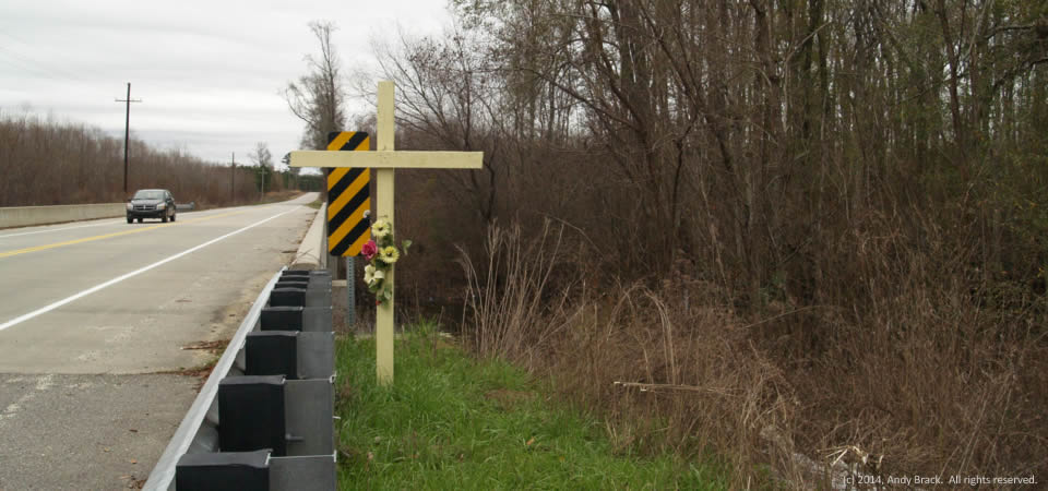
This yellow cross with plastic flowers attached is an all-too-familiar scene across the rural South.  It marks the spot where someone died, likely in a terrible car crash.

This cross is located along S.C. Highway 217 next to a bridge over a swamp of the Little Salkahatchie River just inside Bamberg County near the Colleton County line.

Across the South, highway death rates are comparatively high, but have gone down in recent years thanks to improvements in safety features on vehicles.

Bamberg County is home to about 16,000 people, 27 percent of whom live below the federal poverty level, according to 2012 Census estimates.  The majority of residents are black (61.4 percent) with whites comprising 36.8 percent. 

Photo taken January 2014 by Andy Brack.  All rights reserved.