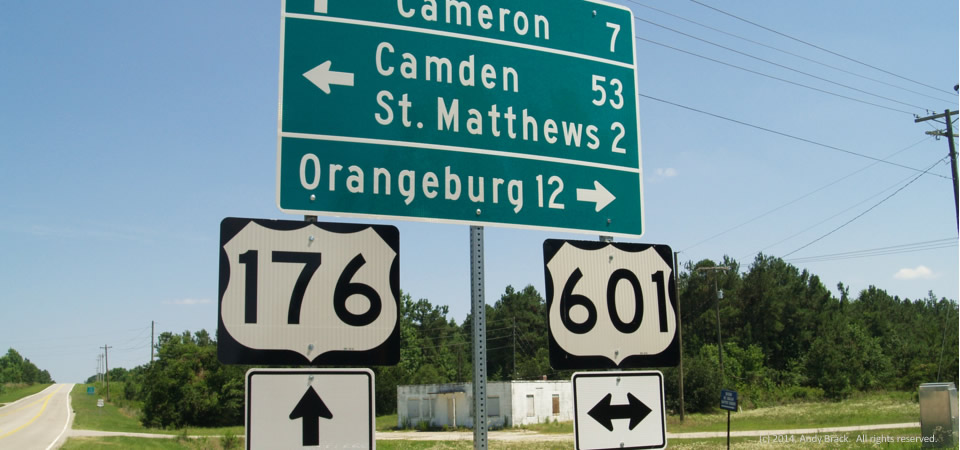
Deserted intersection, Calhoun County, S.C.

Calhoun County, S.C., intersection

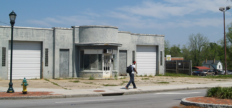
A deserted store is at one corner of an empty intersection in Calhoun County, S.C.  Back in the day before Interstate 26, which is a few miles to the south, this place would have been a busy gathering place for local residents and travelers going between Charleston and the state capital city, Columbia.

Much of Calhoun County is very rural, but because part of it abuts the Columbia metro area, its poverty rate is a little lower than most Crescent areas.  Poverty is 18.2 percent, according to a five-year Census average, less than a point higher than the state average.  The county is, however, relatively small at just over 15,000 people.  About 43 percent of residents are black with whites comprising 55 percent.

Photo taken June 18, 2014, by Andy Brack.  Copyrighted.  All rights reserved.
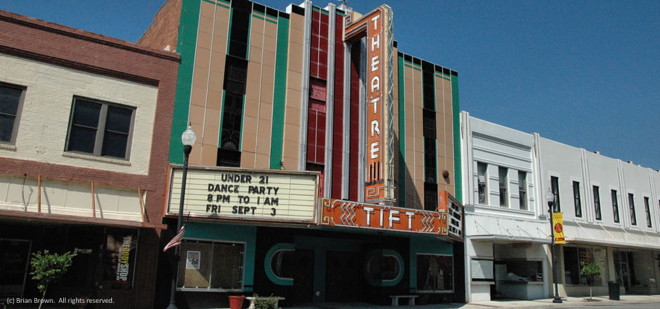
Tift Theatre, Tifton, Ga.

Theatre, Tifton, Ga.
Tift Theatre, Tifton, Ga.

Take a look at this 1937 Art Deco theatre in Tifton, Ga., that contributor Brian Brown published in 2010 on VanishingSouthGeorgia.com.

Tift County, population 40,286 in 2013, is an old agricultural market center that thrived a century and more ago thanks to lumber, cotton and other agricultural products.  Today, it is home to Abraham Baldwin College.  It continues to be a transportation as it is bisected by Interstate 75.  U.S. Highways 82 and 319 also intersect in the county.

About two thirds of Tift residents are white; about a third are black.  About 10 percent of people also identify themselves as Hispanic or Latino, according to the U.S. Census.  The county’s poverty rate is 22.9 percent (2008-2012), but just over 30 percent in the county seat, Tifton (population 16,405).

Photo by Brian Brown, VanishingSouthGeorgia.com.  All rights reserved.

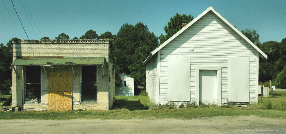
Boarded up, Eldorado, Ga.

Eldorado, Ga.
Eldorado, Ga.

VanishingSouthGeorgia.com photographer Brian Brown snapped this photo in 2008 of two boarded-up buildings in Eldorado, Ga., a few miles south of Tifton, Ga.

Tift County, population 40,286 in 2013, is an old agricultural market center that thrived a century and more ago thanks to lumber, cotton and other agricultural products.  Today, it is home to Abraham Baldwin College.  It continues to be a transportation as it is bisected by Interstate 75.  U.S. Highways 82 and 319 also intersect in the county.

About two thirds of Tift residents are white; about a third are black.  About 10 percent of people also identify themselves as Hispanic or Latino, according to the U.S. Census.  The county’s poverty rate is 22.9 percent (2008-2012), but just over 30 percent in the county seat, Tifton (population 16,405).

Photo by Brian Brown, VanishingSouthGeorgia.com.  All rights reserved.

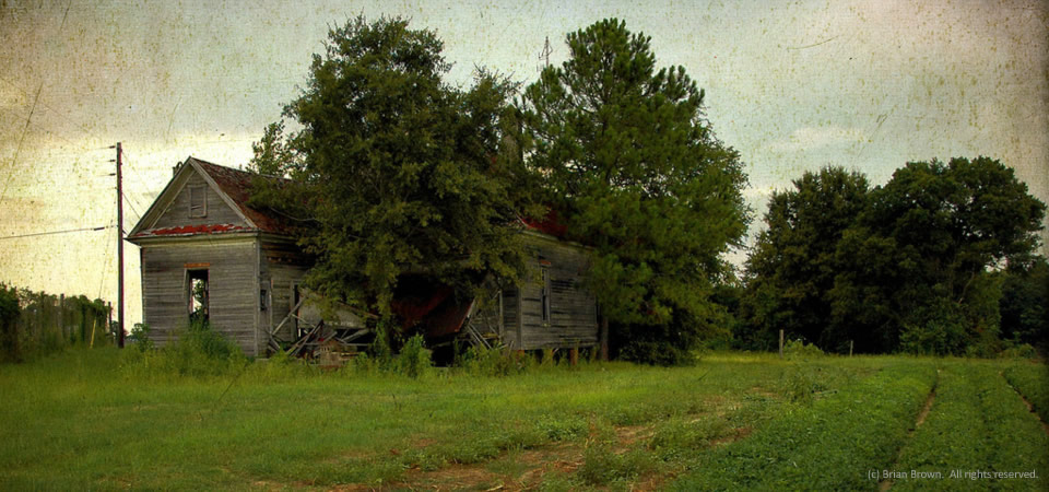
Abandoned farmhouse, Tift County, Ga.

Abandoned farmhouse, Tift County, Ga.


There are a lot of abandoned farmhouses and great old buildings throughout Tift County, Ga., in the middle of wiregrass country, as documented here at VanishingSouthGeorgia.com by photographer Brian Brown.

Tift County, population 40,286 in 2013, is an old agricultural market center that thrived a century and more ago thanks to lumber, cotton and other agricultural products.  Today, it is home to Abraham Baldwin College.  It continues to be a transportation as it is bisected by Interstate 75.  U.S. Highways 82 and 319 also intersect in the county.

About two thirds of Tift residents are white; about a third are black.  About 10 percent of people also identify themselves as Hispanic or Latino, according to the U.S. Census.  The county’s poverty rate is 22.9 percent (2008-2012), but just over 30 percent in the county seat, Tifton (population 16,405).

Photo by Brian Brown.  All rights reserved.

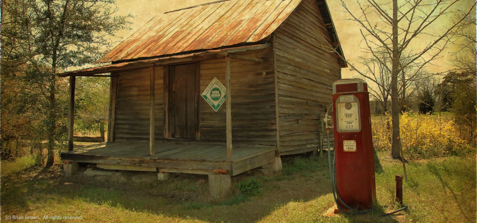
Store, Jordan, Ga.

Tiny store, Wheeler County, Ga.

This store, which VanishingSouthGeorgia.com photographer Brian Brown writes is about all that’s left in the settlement of Jordan in rural Wheeler County, Ga., looks remarkably similar to a building pictured here in Orangeburg County, S.C., more than 200 miles away.

According to 2011 poverty estimates by the U.S. Census, Wheeler County, which had 7,421 people in 2010, had a 42.2 percent poverty rate.  What’s remarkable about that is it is one of the few high-poverty counties where the overall rate is higher than the rate for children under 18.

About two thirds of the residents of the south-central Georgia county are white with the remaining almost all black.

Copyrighted photo taken in March 2014 by Brian Brown.  All rights reserved.

Near the Pig, Orangeburg, S.C.

Russell Street, Orangeburg, S.C.

This crumbling corner on Russell Street near the center of downtown in Orangeburg, S.C., illustrates the challenge that the inner city is having to attract businesses to lure residents to spend time in their downtown.  Despite an attractive central downtown renovation and business like Piggly Wiggly, which you can see in back of this apparently empty old service station, there are few big-name retailers to draw people downtown.

The City of Orangeburg, known for its gardens and historically black colleges, officially is home to 13,850 people and has a 31.3 poverty rate in 2012, but the greater area has more than 65,000 people.  Orangeburg County is home to more than 91,000 people, two thirds of whom are black.  The county has a poverty rate of 24.5 percent.

Copyrighted photo was taken April 23, 2014 by Andy Brack.  All rights reserved.

Downtown park, Orangeburg, S.C.

Downtown Orangeburg, S.C.

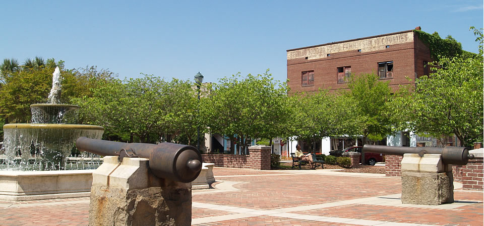
This fountain and brick area in the middle of downtown Orangeburg provides a central oasis of sorts.  Nearby are big local churches and lots of small businesses from finance shops to hair boutiques.  The old square area also features a Confederate statue.

The City of Orangeburg, known for its gardens and historically black colleges, officially is home to 13,850 people and has a 31.3 poverty rate in 2012, but the greater area has more than 65,000 people.
Orangeburg County is home to more than 91,000 people, two thirds of whom are black.  The county has a poverty rate of 24.5 percent.

Copyrighted photo was taken April 23, 2014 by Andy Brack.  All rights reserved.

Tin cabin, Orangeburg County, S.C.

Old cabin, Orangeburg County, S.C.

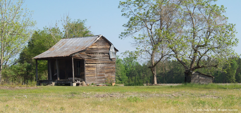
This old one-room cabin with a tin roof is just inside Orangeburg County on U.S. Highway 178 near the Dorchester County line.  Although it’s seen its better days, you can imagine tenant farmers from 80 or more years ago sitting on the front porch.

Orangeburg County is home too more than 91,000 people, two thirds of whom are black.  The county has a poverty rate of 24.5 percent.  The City of Orangeburg, known for its gardens and historically black colleges, officially is home to 13,850 people and has a 31.3 poverty rate in 2012, but the greater area has more than 65,000 people.

Copyrighted photo was taken April 23, 2014 by Andy Brack.  All rights reserved.

Pothole, Orangeburg County, S.C.

Pothole, near Bowman, S.C.

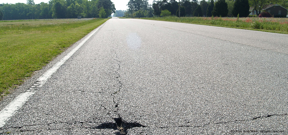
This pothole on U.S. Highway 178 east of Bowman is just one of a gazillion pitting South Carolina roads.  The state has an estimated $27 billion in road and bridge maintenance needs to bring its extensive highway system to being good.  But lawmakers continue to shy from raising the state’s gas tax, one of the lowest in the nation.

Photo by Andy Brack, April 23, 2014.  All rights reserved.

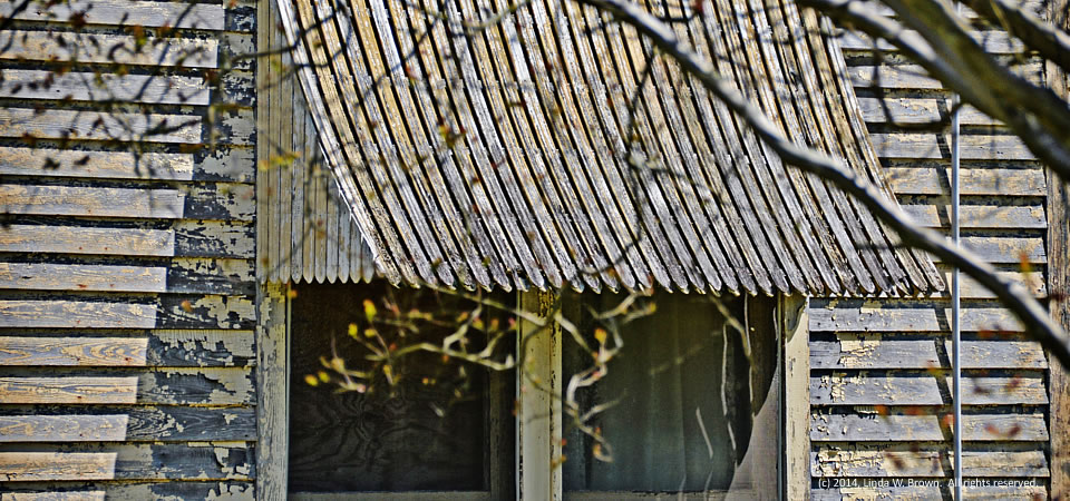
Windows, Cades, S.C.

Rusting awning, Cades, S.C.

A rusting awning covers windows on a house that is showing some signs of renovation in Cades, a small community 10 miles north of Kingstree, S.C., in Williamsburg County, writes retired editor and photographer Linda W. Brown.  Once a thriving railroad town, Cades is now known as a crossroad on U.S. Highway 52.

Photo by Linda W. Brown taken April 17, 2014.  All rights reserved.