Deserted, Santee, S.C.

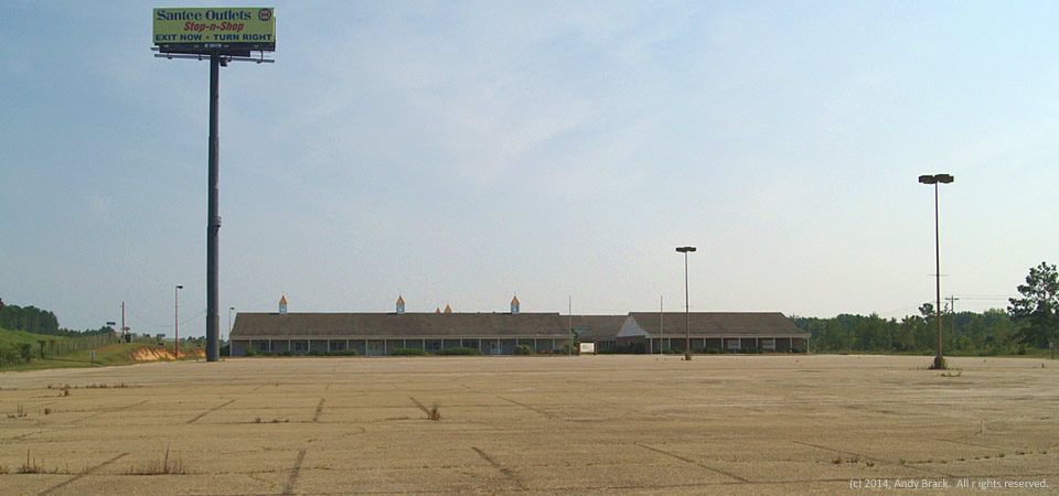
Empty, deserted mall, Santee, S.C.

Santee Outlets used to be a thriving outlet village in the small town of Santee, S.C., along Interstate 95 in the middle of a real dull drive between Savannah, Ga., and Florence, S.C.  Now, however, the facility — once home to about four dozen stores — houses an antiques store and a sheriff’s department substation.  A parking lot that could fit hundreds of cars is empty with weeds and broken glass as its only occupants.

While small shops and fast-food restaurants thrive at the Santee exit, small businesses like those in the outlet took a big hit in the Great Recession.  Santee, home to about 750 people, is in the eastern part of Orangeburg County near Lake Marion.  Orangeburg County is home to more than 91,000 people, two thirds of whom are black.  The county has a poverty rate of 24.5 percent.

Copyrighted photo was taken July 9, 2014 by Andy Brack.  All rights reserved.
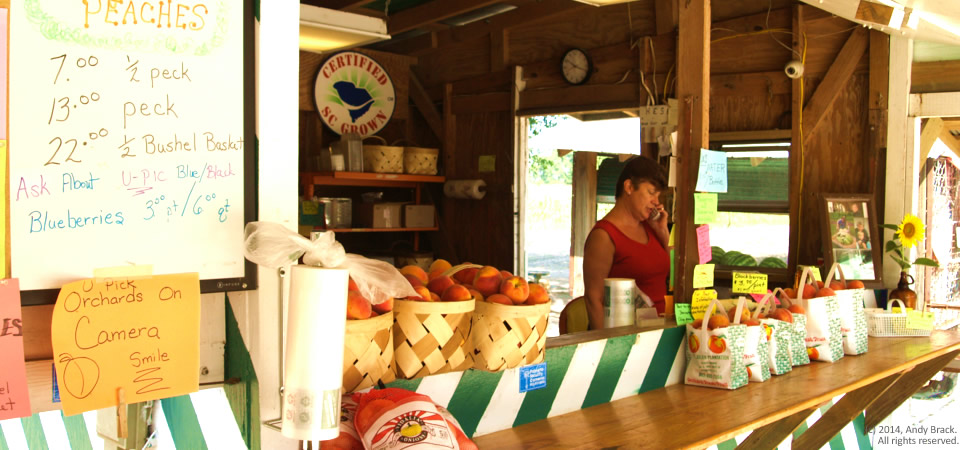
Roadside stand, Eutawville, S.C.

Peaches at the St. Julien Plantation produce stand, outside Eutawville, S.C.

Patti Connor takes a phone call at the St. Julien Plantation roadside produce stand just outside Eutawville, S.C.  At this time of the year, you can find these stands across the rural South offering fresh fruits and vegetables such as peaches, corn, peas, melons, okra and more.

Eutawville, population about 350, is the site of the important Battle of Eutaw Springs, the last major battle of the Revolutionary War in South Carolina.  (More on this in the days ahead.)  The small town is in the eastern part of Orangeburg County near Lake Marion.

Orangeburg County is home to more than 91,000 people, two thirds of whom are black.  The county has a poverty rate of 24.5 percent.

Copyrighted photo was taken July 9, 2014 by Andy Brack.  All rights reserved.

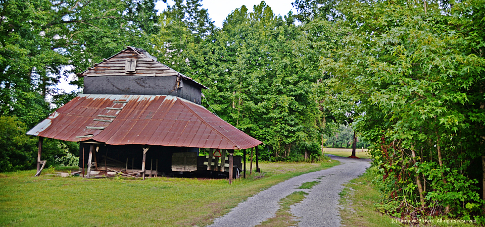
Country lane, Williamsburg County, S.C.


Country lane, Williamsburg County, S.C.

An old barn and a country lane beckon the passerby to see what’s around the bend just off Cedar Swamp Road in rural Williamsburg County, South Carolina.

  • Copyrighted photo was taken June 29, 2014, by Linda W. Brown.  All rights reserved.

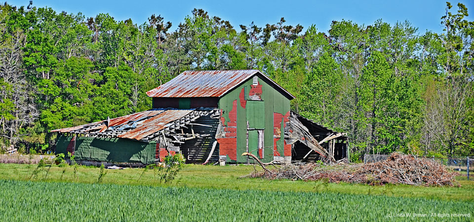
Old barn, Williamsburg County, S.C.

Old barn, Williamsburg County, S.C.

This old barn on Roper Woods Road in eastern Williamsburg County, S.C., is giving way to time, writes photographer Linda W. Brown of Kingstree.  The photo was taken earlier this spring when the winter wheat crop in the foreground was green.

Williamsburg County, which is about 75 miles north of Charleston, S.C., has a population of just under 34,000 people.  Population peaked in 1950 at 43,807, but has dropped slowly since then.

About two-thirds of county residents are black, with almost  all of those remaining being white.  Only 2 percent of those in the county are of Hispanic descent.  Some 32.8 percent of residents live in poverty, according to the Census.  Of the county’s 1,92

1 firms, 36.5 percent are black-owned — a percentage that is three times South Carolina’s average.

Copyrighted photo by Linda W. Brown, taken in Spring 2014.  All rights reserved.

Crescent prominent in new map of poverty areas

Poverty is creeping closer to people living in the American South, according to a new report from the U.S. Census.

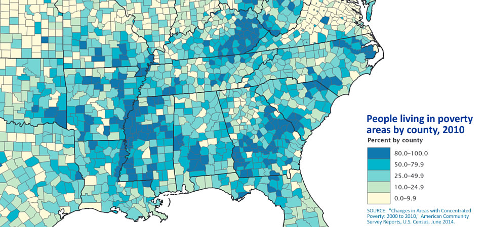
This map from a new U.S. Census report clearly shows high poverty areas that stretch along the Southern Crescent from Virgina through Georgia to the Delta area along the Mississippi River.

Just under one in three people across the South — 30.8 percent — live in a neighborhood or community in which at least 20 percent of people live in poverty.  Just 10 years ago across the region, one in five people — 21.8 percent of Southerners — lived in these “poverty areas.” Continue reading “Crescent prominent in new map of poverty areas”

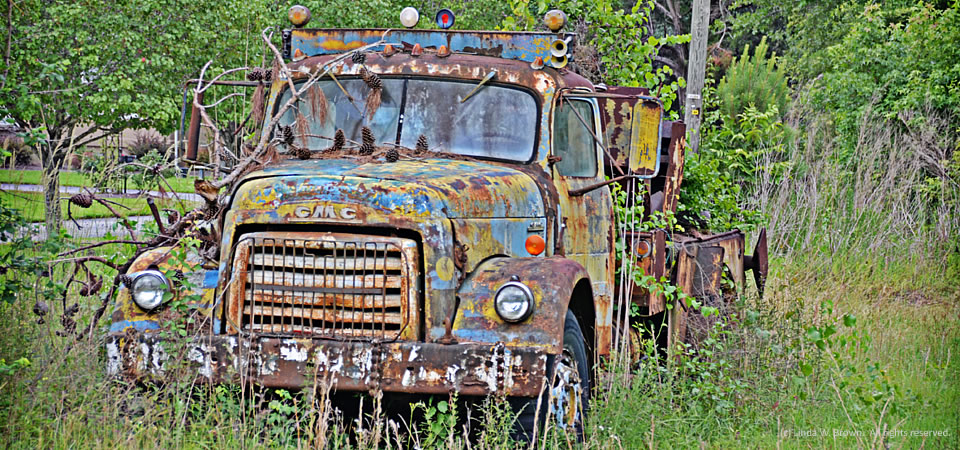
Old GMC truck fades away in Florence County, S.C.

This old GMC truck, despite its coat of rust, still has plenty of character as it sits beside U.S. Highway 52 in Florence County, notes Kingstree, S.C., photographer Linda W. Brown.

Florence Countyhad 137,948 people, according to a 2012 Census estimate.  Its poverty rate — higher in the rural areas than the county seat of Florence, averaged 19.4 percent in 2010.

Copyrighted photo by Linda W. Brown.  All rights reserved.

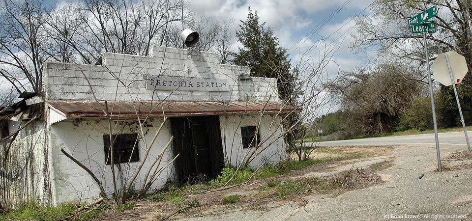
Another abandoned store, Pretoria, Ga.

14.0625.ga_pretoria
Pretoria Station, Dougherty County, Ga.


Here’s yet another abandoned rural store, this one called “Pretoria Station” in Dougherty County, which is home to the county seat of Albany.

Dougherty County is home to almost 93,000 people, according to 2013 U.S. Census estimates.  Two-thirds of residents are black, with 30 percent being white.  An estimated 30.6 people live in poverty, according to Census figures.  The story is the same for Albany, where all but 17,000 of the county’s residents live.  But the poverty rate is higher — 34.2 percent, about twice what is Georgia’s state average.

Copyrighted photo is by Brian Brown, VanishingSouthGeorgia.com.  All rights reserved.

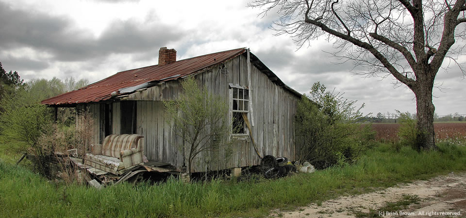
Tenant farmhouse, Isabella, Ga.

14.0627.ga_isabella_worthco
Tenant farmhouse, Isabella, Ga.

Here’s a dilapidated, crumbling tenant farmhouse in the Isabella of rural Worth County, which is located between Albany and Tifton in the central part of South Georgia.  The county is home to Peter Pan Peanut Butter.  Every jar made is produced in the county seat, Sylvester.

The county had about 21,300 people in 2013, according to the Census with whites representing 68.7 percent and blacks being 29.6 percent. Some 22 percent of people live below poverty levels, according to Census figures.

Photo by Brian Brown from VanishingSouthGeorgia.com is copyrighted.  All rights reserved

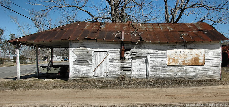
Tison Grocery, Doles, Ga.

T.W. Tison Grocery, Doles, Ga.

This is the old T.W. Tison Grocery in Doles, Ga., in rural Worth County.  Stores like this used to dot rural landscapes but many, as highlighted by Brian Brown in VanishingSouthGeorgia.com, are wasting away and closed.

Worth County, which is located between Albany and Tifton in the central part of South Georgia, is home to Peter Pan Peanut Butter.  Every jar made is produced in the county seat, Sylvester.  The county had about 21,300 people in 2013, according to the Census with whites representing 68.7 percent and blacks being 29.6 percent. Some 22 percent of people live below poverty levels, according to Census figures.

Photo by Brian Brown is copyrighted.  All rights reserved

Office, Clarendon County, S.C.

Still in use as an office, Clarendon County, S.C.

This old house on S.C. Highway 260 in Clarendon County outside of Manning is now the office for a septic tank company, writes Kingstree photographer and retired editor Linda W. Brown.  Once a rural area, this road which leads to Lake Marion is now lined with commercial establishments.

Clarendon County has 34,357 people, according to the U.S. Census Bureau’s 2012 population estimate.  About half of the county’s residence are white; the other half are black.  Some other statistics:

  • High school graduation rate of those 25 or older:  76.3 percent.
  • Bachelor’s degree graduates:  13.8 percent
  • Median household income:  $33,267
  • Poverty rate:  22.8 percent
  • Unemployment rate, November 2013: 9.9 percent (2.5 percent higher than the state average)
  • Black-owned firms:  30.1 percent (18 points higher than state average)
  • Women-owned firms:  35.4 percent (8 points higher than state average)

Photo taken October 2013 by Linda W. Brown.  Copyrighted; all rights reserved.