Happy Halloween

Haunted Montrose, Montrose, Ga.

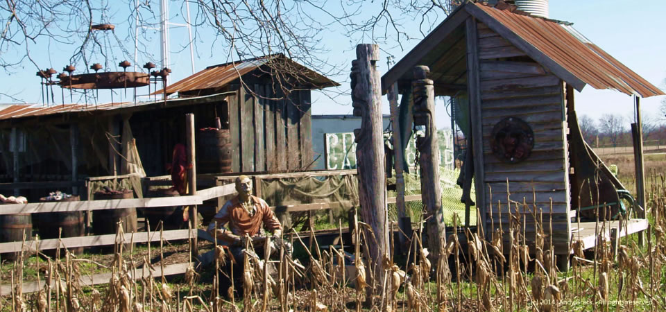
Just looking at this ghoulish photo of an that’s part of Haunted Montrose in Georgia gives us the willies.  The seasonal attraction is a boost to the economy of this small Laurens County town of Montrose, population 154.  Most interesting is how folks in this small community put the town on the map in a non-agricultural time of the year to generate extra revenue.  See earlier photo.

Montrose, located in central Georgia, has a relatively low poverty rate of 11.2 percent, although 30 percent of its children live in poverty. Some 23.6 percent of residents of Laurens County (population 48,434) live in poverty, according to Census data

Photo taken Feb. 16, 2014 by Andy Brack.  All rights reserved.

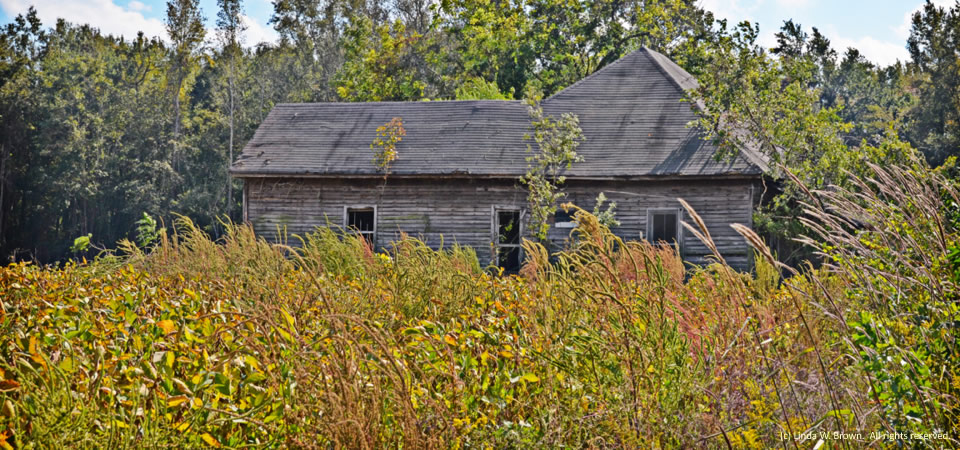
Forgotten house, Florence County, S.C.

Forgotten house, Florence County, S.C.

Autumned-browned weeds almost obscure this old house on Kirby Road in rural Florence County, S.C., writes photographer Linda W. Brown of nearby Kingstree.

Florence County had 137,948 people, according to a 2012 Census estimate.  Its poverty rate — higher in the rural areas than the county seat of Florence, averaged 19.4 percent in 2010.

Copyrighted photo taken in October 2014 by Linda W. Brown.  All rights reserved.


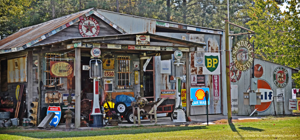
Signs, Florence County, S.C.

Signs, signs and more signs.

Photographer Linda W. Brown of Kingstree, S.C. sent along this picture recently from nearby rural Florence County that shows an old store full of signs from all times — plus a couple of vintage gas pumps.

Photo is copyrighted 2014, Linda W. Brown.  All rights reserved.

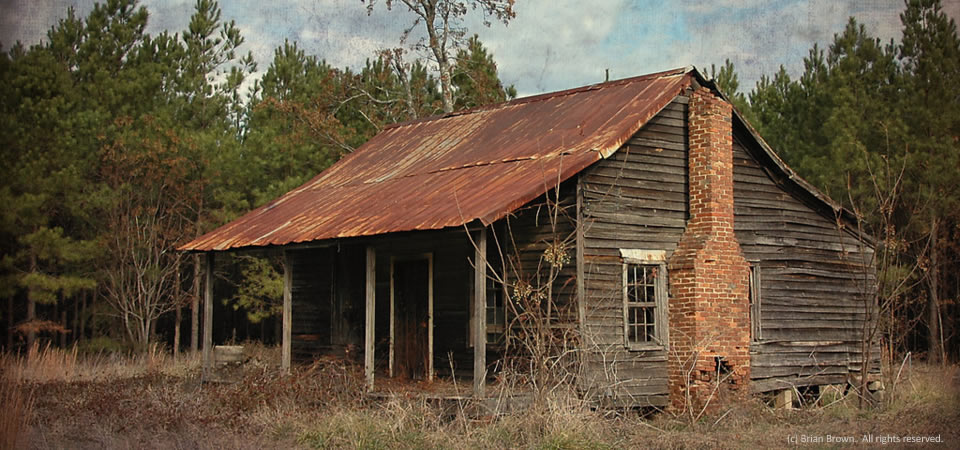
Georgia Cracker, Washington County, Ga.

"Georgia Cracker" farmhouse, Washington County, Ga.
“Georgia Cracker” farmhouse, Washington County, Ga.

VanishingSouthGeorgia.com photographer says this kind of farmhouse in rural Washington County, Ga., is known sometimes a “Georgia Cracker.”  It “was once widespread throughout the region.  It’s becoming quite rare today,” he wrote here in 2013, where you can see more photos.

The county, which is in central Georgia, is named for George Washington prior to him becoming president.  It is the only county in the country to be named for him as a general.  Some 20,676 people live in the county, which has Sandersville as the seat of government.  Thirty percent of children live below the federal poverty line.

Copyrighted photo by Brian Brown, 2013.  All rights reserved.

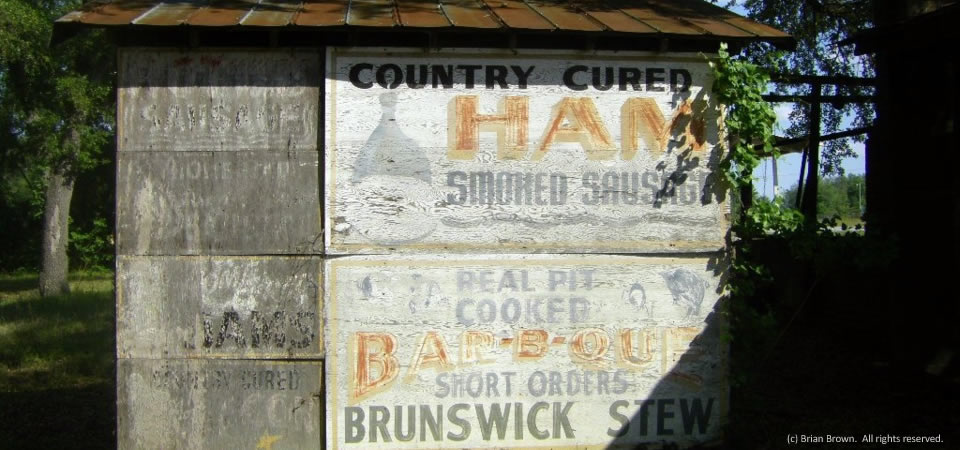
Sign of the times, near Soperton, Ga.

Old barbecue sign, near Soperton, Ga.

You can tell how popular pork products are through this old sign on a barn near Soperton, Ga.  We remember the smoky tastiness of barbecue and Brunswick stew from rural Treutlen County from childhood.  The photo is by VanishingSouthGeorgia.com photographer Brian Brown.

The county, almost in the middle of Georgia, is home to about 6,700 people, two-thirds of whom are white.  Some 26 percent of the population live at or below the federal poverty line.

Copyrighted photo by Brian Brown.  All rights reserved.


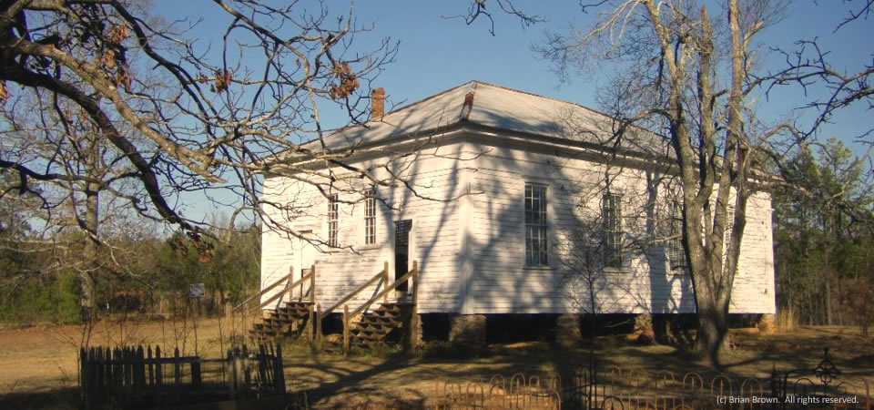
Old church, Stewart County, Ga.

Providence Methodist Church, Stewart County, Ga.

Providence Methodist Church, circa 1859 in rural Stewart County, Ga., has always caught the attention of VanishingSouthGeorgia.com photographer Brian Brown.  It’s a fascinating church, he said here, that is located in western Georgia on the Alabama line in the small county — population 5,803 in 2013.

“On my last visit, however, I was appalled at the horrible condition of the cemetery,” he wrote after this 2011 photo..  “This is on state park land (or at least accessible only via state park road at which an entrance fee is collected) and an absolute disgrace to the department. I realize budget cuts have been a constant source of despair, but surely a friends group or volunteer organization could assist with its cleanup. It’s one of the oldest cemeteries in this section of the state, and if the government is going to oversee and promote the [Providence] canyon as a tourist attraction, it should have some respect for the pioneer citizens who rest permanently on its grounds.”

The county, where about 30 percent of those who are under 18 live in poverty, has lost population since 2010 and is about at its 1980 level in population.  In its agricultural peak in 1900, almost 16,000 people lived in Stewart County.

Copyrighted photo by Brian Brown, 2011.  All rights reserved.

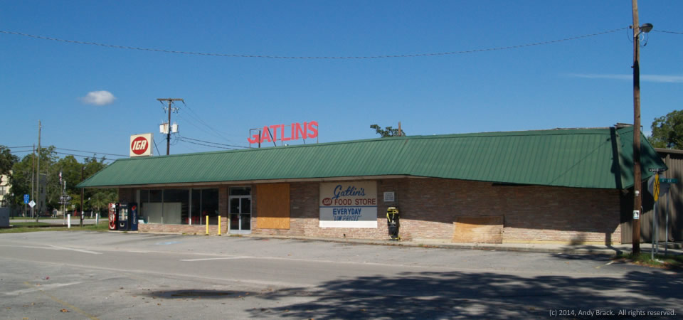
Another closed grocery store, Fairfax, S.C.

The only grocery store in Fairfax, S.C., an IGA known as “Gatlin’s,” reportedly closed about a year ago.  That followed an earlier closure of a Galaxy food mart profiled here in June 2013.

Closed, Fairfax S.C.

Today, the only grocery store that serves rural Allendale County is another IGA in Allendale, which means people from Fairfax have to drive to Allendale or Hampton just to buy groceries. [We’re told by Allendale-area residents that the Fairfax store may open again soon.]

“Food deserts” are often found in poor urban and rural communities because  it’s hard to find grocery stores with lots of healthy options.  People who live in food deserts may only have one store that stock more packaged and canned food than they do fresh foods.  In turn, having fewer options tends to support unhealthy eating habits that lead to higher incidents of diabetes, heart disease, stroke, obesity and more.

With just over 40 percent of Allendale County’s 10,000 people living at or below the poverty level, the median household income is about $23,000 a year — half of South Carolina’s average and well below the nation’s $50,000 average.

Photo by Andy Brack, Center for a Better South, Oct. 1, 2014.  All rights reserved.

Rural leaning tower, Colleton County, S.C.

Leaning Tower of Colleton?

This slightly off-kilter grain tower in the western part of Colleton County along S.C. Highway 641 reminded the photographer’s daughter of the Leaning Tower of Pisa.

Along the edge of the Southern Crescent, Colleton County is split by Interstate 95, which makes it poised for growth.  Still, lots of the large county is rural.  Walterboro is the seat of government in Colleton County, which is home to 38,153 people, 21 percent of whom live at or below the federal poverty level.

Photo taken Oct. 1, 2014, by Andy Brack.  All rights reserved.
Fading painted icon, Colleton County, S.C.

Fading flag, Colleton County, S.C.

Across much of the South, overt symbols of the past, such as the Confederate battle flag, are slowly fading into the past, much like the paint on this barn at Confederate Farm in the western part of Colleton County, S.C., on S.C. Highway 641.

Along the edge of the Southern Crescent, Colleton County is split by Interstate 95, which makes it poised for growth.  Still, lots of the large county is rural.  Walterboro is the seat of government in Colleton County, which is home to 38,153 people, 21 percent of whom live at or below the federal poverty level.

Photo taken Oct. 1, 2014, by Andy Brack.  All rights reserved.
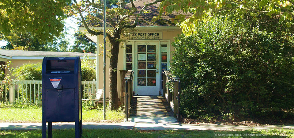
Tiny post office, Sycamore, S.C.

One-room post office, Sycamore, S.C.

Sycamore, a South Carolina village in Allendale County of about 180 people,has a tiny, one-room post office on Main Street just off the main highway.  It’s open from 8 a.m. to 10 a.m. on weekdays and from 8 a.m. to noon on Saturdays.  According to a 2011 story, this post office and 27 others across South Carolina were scheduled for closure.

Sycamore is about 60 percent white with a 35 percent black community of residents.  Unlike the whole of Allendale County with its almost 40 percent poverty rate, poverty is comparatively low at 10 percent in Sycamore.

Photo by Andy Brack, Center for a Better South, Oct. 1, 2014.  All rights reserved.