Old store, Ebony, Va.

Old store, Ebony, Va.  Photo by Andy Brack; all rights reserved.
Old store, Ebony, Va. Photo by Andy Brack; all rights reserved.

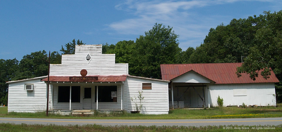
This empty, old store in Ebony, Va., is one of the favorite buildings we’ve spotted recently in our rambles around the Southern Crescent.  Perhaps one reason is how the sign above the door has faded to reveal an upside-down word, “sandwiches.” Something else was painted over it years back, but this is what’s left now.

The way we hear it from folks in Ebony, the rural village in Brunswick County once was known as the Prospect area.  But when it had grown enough to get a post office, the postal authorities said they couldn’t name it “Prospect” because there already was a post office with that name in Virginia.  So one of the town elders figured that if they couldn’t name it “Prospect,” they might as well name it after a great old black horse he had in his pasture named (you guessed it) “Ebony.”

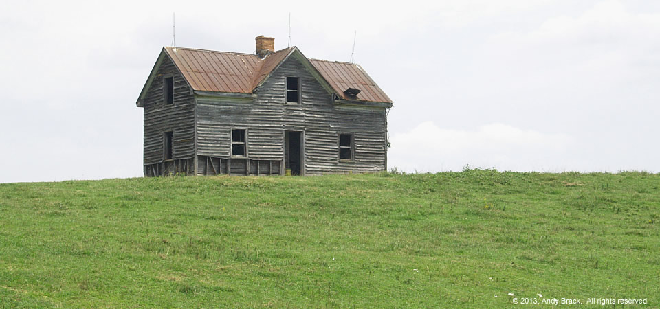
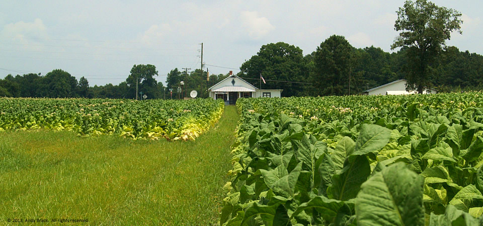
Brunswick County is a farming area on the North Carolina border with more than 17,000 residents.  Like most Southern Crescent counties, poverty exceeds 20 percent.

Copyrighted photo taken July 24, 2013, by Andy Brack, Center for a Better South.  All rights reserved.

House with a view, near Gasburg, Va.

Old farm house with commanding presence, near Gasburg, Va.  Photo by Andy Brack.
Old farm house with commanding presence, near Gasburg, Va. Photo by Andy Brack.

This imposing, empty old farm house dominates a hilly cow pasture outside Gasburg, Va., near the intersection of Spraggins and Oak Grove roads.

Several people who viewed the photo said it reminded them of Andrew Wyeth’s famous 1948 painting “Christina’s World” — just without Christina.

A post office deliveryman said he recently saw a black bear chasing cows on the property where last week butterflies swarmed around blooming milkweed and Queen Anne’s lace.

Gasburg is in rural Brunswick County, a farming area on the North Carolina border with more than 17,000 residents.  Like most Southern Crescent counties, poverty exceeds 20 percent.

Copyrighted photo taken July 24, 2013, by Andy Brack, Center for a Better South.  All rights reserved.

New poverty study challenges assumptions

Better South President Andy Brack discussed a new Harvard poverty study that shows poor upward mobility in the Southern Crescent region in the recent issue of Statehouse Report.  From the commentary:

For Americans trying to escape poverty, location matters – just like in real estate. And if you live in the Deep South, it’s harder to escape than about anywhere else in the country, just as generations of us have known.


Throughout every area of South Carolina, jumping from the bottom quintile of income to the middle class or beyond is tough, according to a new Harvard study making waves in policy circles.


In the Columbia area, for example, a child has a 36.6 percent chance of rising out of the bottom quintile of income and a 4.2 percent chance of leaping from the bottom to the top quintile. Those probabilities are among the lowest in the nation and not much different from the number for Greenville, where kids have a 37.7 percent chance to escape poverty and a 4.9 percent chance to be among the nation’s highest earners. Researchers found similar low numbers for Memphis, Charlotte, Atlanta and Raleigh.


“Where you grow up matters,” Harvard economist and researcher Nathaniel Hendren told The New York Times. “There is tremendous variation across the U.S. in the extent to which kids can rise out of poverty.”


The new study is drawing attention for what it found, but also for what it didn’t find. Researchers crafted the study by analyzing millions of anonymous earnings records to measure intergenerational mobility, or how children move across income levels compared to their parents.


The research team was interested in whether tax breaks and credits, such as the Earned Income Tax Credit, were correlated to high mobility, or the ability of kids to move out of poverty. They found some correlation between local tax rates and mobility, but a weaker correlation between state EITC policies and mobility.


So they looked for other factors to explain why some areas had high mobility out of poverty and others, like Southern states, had low mobility. They identified four correlations, but emphasized they were not causes:

  • Family structure. “The share of households with kids that are headed by a single mother is a very strong predictor of mobility,” research associate Alex Olssen told Statehouse Report. The study indicated income mobility was higher in areas with more two-parent households.

  • Local middle class. The density that poor families are dispersed among mixed-income neighborhoods appear to be correlated. “Areas in which low income individuals were residentially segregated from middle-income individuals were also particularly likely to have low rates of upward mobility,” according to the study.

  • Better schools. Income mobility is higher when a metro area has better primary and secondary schools. Having an array of colleges and their tuition rates don’t appear to be as significant, according to study’s results.

  • Civic engagement. The more chances for civic engagement, including with religious and community groups, the better the upward mobility.

For the full commentary, click here.

Tobacco field, Valentines, Va.

Tobacco field, Valentines, Va., 2013.  Photo by Andy Brack.
Tobacco field, Valentines, Va., 2013. Photo by Andy Brack.

Tobacco is maturing in fields across the Southern Crescent, including this patch in rural Valentines in the southeastern part of Virginia.  In the background is Wright’s Gen. Mdse., an old-time country store that doubles as a post office.  Much of the store is an homage to how old country stores used to be, but you can still buy some stuff like cold drinks and crackers.

Tobacco production remains a viable business across the South, particularly the flue-cured tobacco of the American South that is used in higher-end tobacco products across the world.  While China outpaces American production four-fold or more, American tobacco apparently is preferred to help flavor products.  U.S. production in 2012 was about 500 million pounds and is expected to be in high demand again this year.  More info.

This photo in the unincorporated Valentines community is in Brunswick County, a farming area on the North Carolina border with more than 17,000 residents.  Like most Southern Crescent counties, poverty exceeds 20 percent.

Copyrighted photo taken July 24, 2013, by Andy Brack, Center for a Better South.  All rights reserved.

Old store, Bartow, Ga.

13.0725.ga_pepsimural

Vanishing South Georgia photographer Brian Brown offers this 2010 Pepsi image from Bartow, Ga.  The photo serves to balance an earlier post of a Coca Cola advertising mural in Mount Vernon, Ga., which is about an hour south.

“The mural at Bartow is on a building that was once a thriving local grocery store,” Brown says.  “Bartow has always been a small town, with a scattering of churches and businesses, but as is the case in so many of these places, all that remains is the advertising to even suggest that it was once a gathering place.”

Bartow (population 286) is in Jefferson County, a Crescent county with an estimated 16,432 people in 2012.  Some 54 percent of residents are black, with almost all of the remaining people in the rural county being white.  About 29 percent of people live in poverty.

2010 photo, copyrighted by Brian Brown. All rights reserved.

Walking down the street, Lumber City, Ga.

Pedestrian, Lumber City, Ga.  Photo by Brian Brown.
Pedestrian, Lumber City, Ga. Photo by Brian Brown.

Vanishing South Georgia photographer Brian Brown offers this photo of a pedestrian walking down a Lumber City, Ga., street that has a medical clinic behind the bright red doors.

Lumber City has about 1,300 people, a third of whom live in poverty.  It’s on the eastern tip of Telfair County, which as 16,349 people, according to the 2012 Census estimate.  Just over 60 percent of residents are white.  About 36 percent are black.  About 13 percent of people consider themselves to be Hispanic or Latino.  As with Lumber City, a third of the county’s population lives in poverty.

2012 copyrighted photo by Brian Brown.  All rights reserved.


Family farm, Owensboro, Ga.

"Motion" picture of family farm near Owensboro, Ga.  By Brian Brown.  All rights reserved.
“Motion” picture of family farm near Owensboro, Ga. By Brian Brown. All rights reserved.

For Georgia photographer Brian Brown, this family farmhouse near Owensboro, Ga., represents the heart of small-family farming operations.

“Owensboro is a ghost town today, with nothing but fields and farming, but once supported several businesses and many more families lived there fifty years ago than do today,” Brown writes.

Owensboro is in Wilcox County, one of the Peach State’s smaller counties with 9,068 residents, according to the U.S. Census.  About two thirds of residents are white and a third black.  Estimates by the U.S. Census are that 27.4 percent of county residents live in poverty.

2008 photograph courtesy of Brian Brown, VanishingSouthGeorgia.com.  All rights reserved.

Old gin, Kingstree, S.C.

Old gin, Kingstree, S.C.

Years ago, the Cooper Brothers Gin in Kingstree, S.C., was one of Williamsburg County’s most important businesses, writes photographer and retired editor Linda W. Brown.

“Today, it sits abandoned just off Longstreet Street/Highway 52. Many longtime residents are not even aware it’s there behind Cabbage’s Tire Service, although it is visible both from Longstreet and from the Kingstree Police Department parking lot.

“To me it exemplifies that we live such fast-paced lives that we are often not aware of the past or of parts of our history even when they’re visible to us every day.”

Williamsburg County, located in the middle of the Southern Crescent, is about 75 miles north of Charleston, S.C.  Just under 34,000 people live in the county, which is about the number who lived there in 1900, according to Census figures.  Population peaked in 1950 at 43,807, but has dropped slowly since then.

About two-thirds of county residents are black, with almost  all of those remaining being white.  Only 2 percent of those in the county are of Hispanic descent.  Some 32.8 percent of residents live in poverty, according to the Census.  Of the county’s 1,921 firms, 36.5 percent are black-owned — a percentage that is three times South Carolina’s average.

Copyrighted photo by Linda W. Brown, courtesy of the photographer.  All rights reserved.

Old depot, Plains, Ga.

Old depot, Plains, Ga.  Photo by Andy Brack.
Old depot, Plains, Ga. Photo by Andy Brack.

This old train platform in Plains, Ga., is preserved at the Jimmy Carter National Historic Site to highlight what an old train depot used to look like.  The other end of the building was the first campaign headquarters for Carter’s 1976 successful bid for the presidency.

We liked how the Park Service kept this part of the depot because it recalls simpler, slower times without all of the hustle and bustle of modern life (cell phones, computers, GPS, etc.)

Plains, about 15 miles west of Americus in Georgia’s agricultural heartland, had 776 people in 2010, according to the Census.  Three in five residents are black, with whites comprising almost all of the rest.  About a quarter of the population lives below the poverty line.

Photograph taken May 15, 2013, by Andy Brack, Center for a Better South.  Copyright 2013.  All rights reserved.

Campaign headquarters, Plains, Ga.

Carter campaign headquarters, Plains, Ga.  Photo by Michael Kaynard.
Carter campaign headquarters, Plains, Ga. Photo by Michael Kaynard.

In 1975 in this old train depot in Plains, Ga., former President Jimmy Carter started what some thought would be an unlikely presidential campaign.  The depot, now part of the Jimmy Carter National Historic Site, reportedly operated from 1888 to 1951 in this town of about 700.  Carter and his wife, Rosalynn, grew up in Plains.

Photographer Michael Kaynard noted, “There is a block of tourist businesses just down from the train depot Carter used as his campaign headquarters.  Other attractions include his boyhood farm, Plains High School, Billy Carter’s gas station, Rosalynn Carter’s family home and the private Carter compound. Some of the land is being used for agriculture but it would be bypassed except for its ties to the President and his family.”

Plains, whose public school system was absorbed into that of nearby Americus and Sumter County, had 776 people in 2010, according to the Census.  Three in five residents are black, with whites comprising almost all of the rest.  About a quarter of the population lives below the poverty line.

Photograph taken May 15, 2013, by Michael Kaynard, Kaynard Photography.  Copyright 2013.  All rights reserved.